Table of Contents
Terrestrial Fibre Optic Networks
Zayo
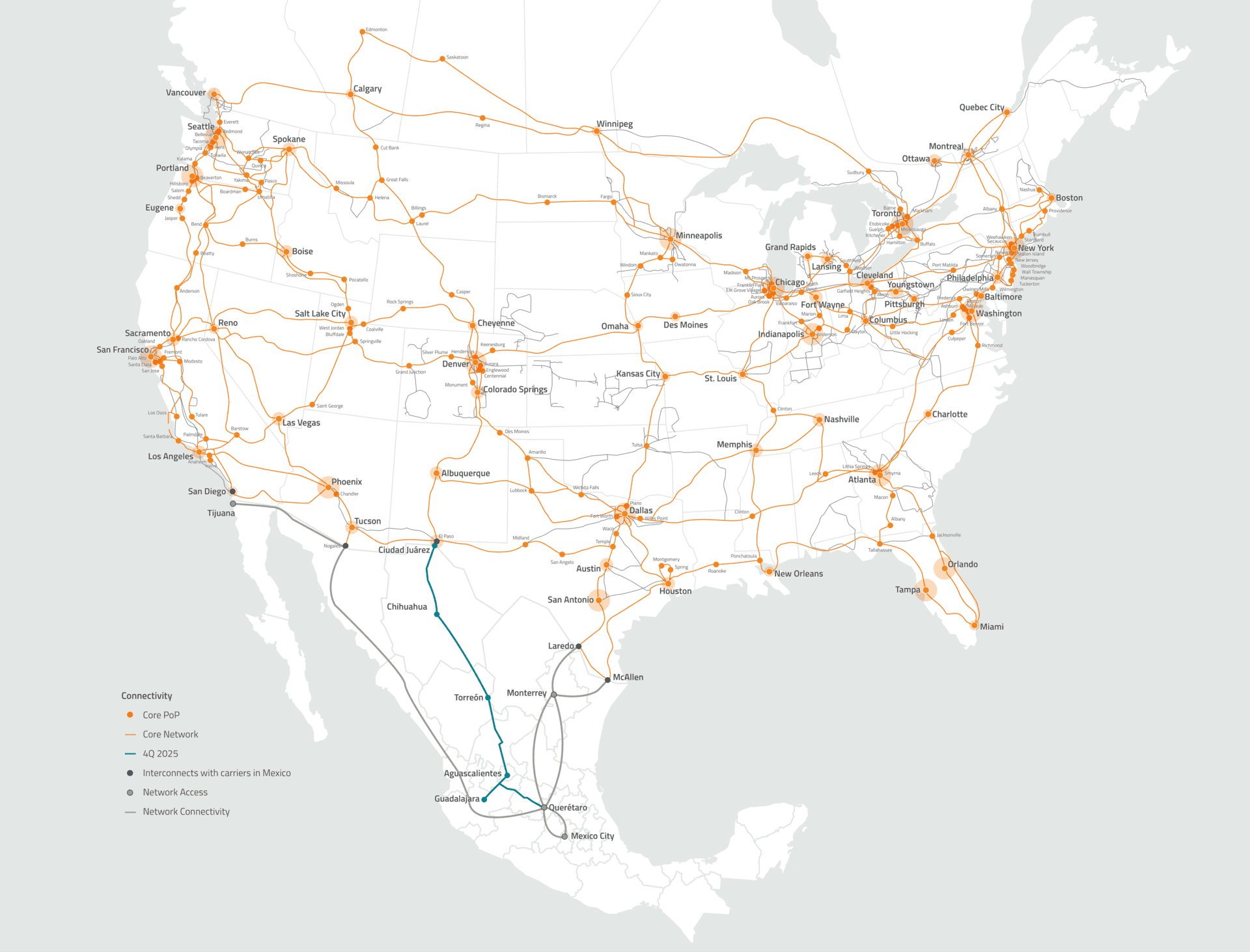 Zayo is a fibre network operator in the United States that publishes a map of their fibre routes and Point of Presence.
OpenNet Georgia
 OpenNet is a state-funded national fibre optic backbone in Georgia. The initiative maintains an interactive public map of the network including both fibre routes and Points of Presence. Beyond an online map, the underlying map data is available to download in KML and Microsof Excel format. The project objective is to increase access to affordable high-speed internet throughout the whole of Georgia, with the intent of helping private operators to build retail networks and to getting the internet to the end users.
ARCEP France
The French communication regulator (ARCEP) maintains a detailed map of FTTH deployments which allows for the visualisation of the coverage of municipalities by FTTH networks. Clicking on a municipality, reveals detailed coverage information for the municipality in question down to the household level. When the map is zoomed to the neighbourhood level, the addresses listed by the different infrastructure operators are displayed, represented by a dot, the colour of which varies according to the progress of the deployment.
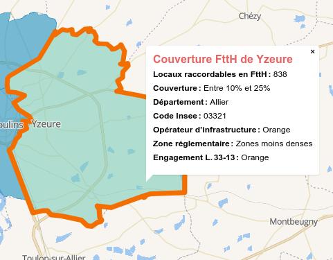 This map is published by ARCEP in order to improve information for the general public and professionals on the deployment of fibre optic networks to the subscriber. Established both at the municipal level and at the technical level (generally at the sub-municipal level), it is part of the Authority's fixed broadband and very high speed observatory and is accompanied by the publication of the underlying data in open data.
Operators provide ARCEP with detailed data on their deployment of fibre optic networks. ARCEP aggregates the data obtained using INSEE geographical codes to obtain an absolute number of premises per municipality that can be connected to the FTTH network. All of the underlying data is part of the government's Open Data initiative and is available for download so that it might be integrated with other resources by researchers or entrepreneurs.
Dark Fibre Africa
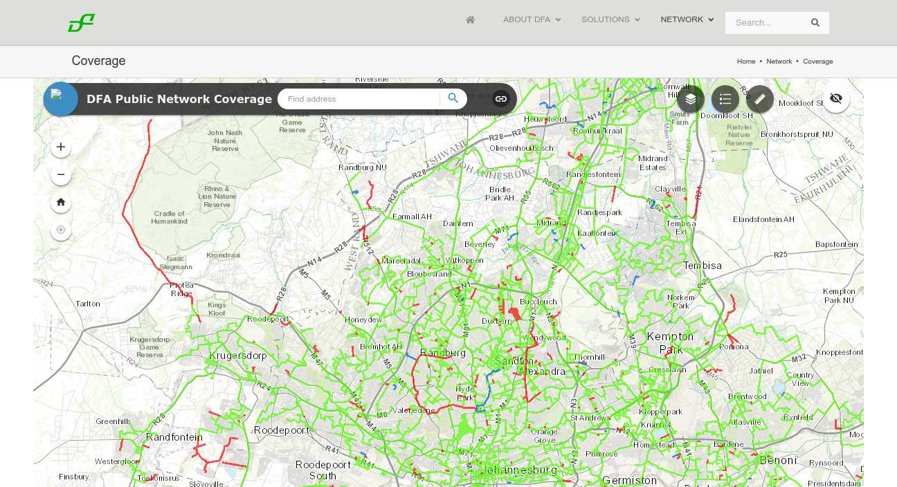 Dark Fibre Africa maintain a detailed map of their South African fibre optic network online. They used to have a downloadable KML version of the map on their website but a link to that has been removed. They maintain their map on an ArcGIS enterprise server which can be accessed via a public API, making it available to other GIS applications. It isn't clear whether this is intentional or not.
Open EIR
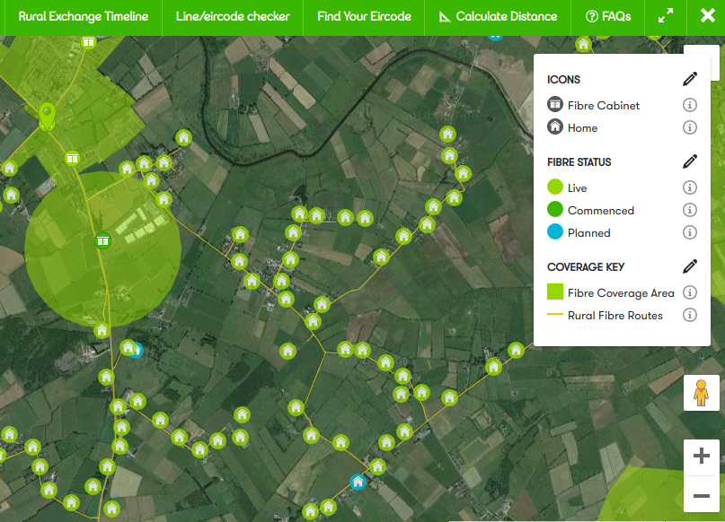 Open EIR is the former state-owned telecommunications monopoly in Ireland. They publish a detailed public map of their fibre network roll-out right down to details of the fibre cabinet, fibre routes, connected buildings, and planned connection. The map is overlaid by default of a Google satellite view background which makes for an impressively detailed map.
Liquid Telecom
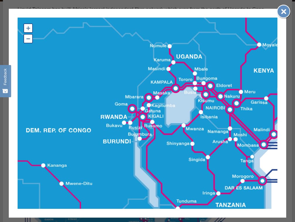 Pan African fibre optic network operator Liquid Telecom maintain a map of their fibre network on their website. While this map is generally helpful, it doesn't display point of presence, nor does it reveal the specific routes that the fibre follows. This is one step up from not displaying a coverage map at all but falls short of being useful for strategic planning.
Telefonica Spain
 Registered operators in Spain can access Telefonica's database of registers and ducts in order to plan their network deployments. Source: Guifi.net presentation at GAIA meeting, IETF 104.
BCN Nigeria
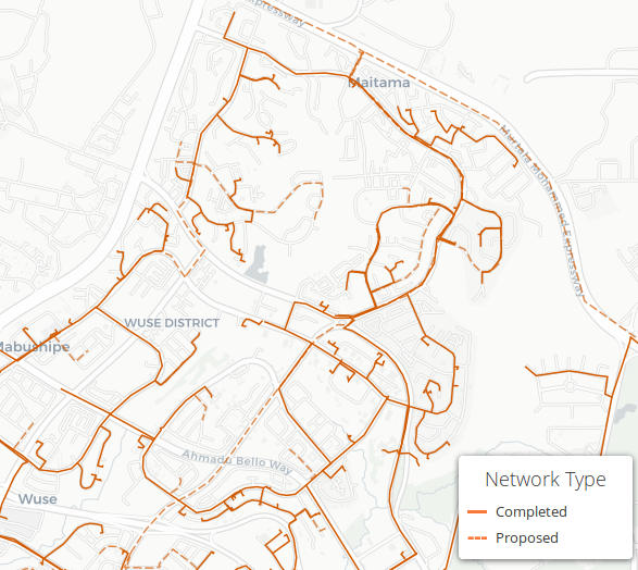 BCN Nigeria publish a detailed map of both their existing and planned FTTH network.